Museum Entrance Museum
Museum
Friends of Durham Mining Museum
Events Calendar
e-Books and Books for sale
Photograph Gallery
Document Archive
Main Document Archive
Newspaper Articles
Local Record Extracts
D.M.A. Document Archive
Transactions of I.M.E.
Miners' Welfare
N.C.B. Archive
The Colliery Engineer
The Colliery Guardian
Mine & Quarry Engineering
Mine & Quarry Engineering - Main Index
Mine & Quarry Engineering - Subject Index
Mining Journal
The Science and Art of Mining
Coal Magazine
Coal News
Coke and Gas
Master Name Index
What's new in the site
Mining
Mining History
Colliery Index
Colliery Maps
Company Overviews
Who's Who
Mineral Information
Managers Certificates
Educational Material
Bibliography
Statistics
Workers/Employee Lists
Notes for Family Historians
War Service information
Disasters
Disaster Reports
Names of those killed
Disasters in the 1700s
Disasters in the 1800s
Disasters in the 1900s
Memorials
Awards for Gallantry
On this day ...

Links to other sites of interest
Industrial Heritage Days Out
Former www.pitwork.net web site

Index to site

Contact and address details

Share Page with Social Media

Share on Facebook

Share with Reddit

Share on Delicious

Title Prev Page Return to Index Next Page Title
Masthead
September, 1954

Lead Mining in the British Isles — Part 2

Drawings and Photographs accompanying the article

Sample Description
Thumbnail Fig. 9. — Geological section of typical Derbyshire orefield, showing how the migrating ore solutions have formed pools under impervious covers of shale and/or lava/toadstone, and the effect of surface denudation in reducing the depth of ore-bearing zones
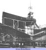
Thumbnail Fig. 10. — Surface buildings and dump at Mill Close Mine
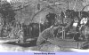
Thumbnail Fig. 11. — Mather and Platt pump installation, Mill Close Mine
Thumbnail Fig. 12. — Typical unexplored mining area — section Mason Hill to Ashover Hay
Thumbnail Fig. 13. — A typical "swarm," Grassington Moor Mines, Yorkshire
Thumbnail Fig. 14. — A view of the pump room at Mill Close
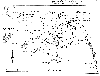
Thumbnail Fig. 15. — Plan of the Llanrwst orefield. A Typical "swarm" in the Ordivician
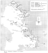
Thumbnail Fig. 16. — Districution of Fluorspar in the Southern Pennines
Thumbnail Fig. 17. — Part of Mill Close Mine showing the assmeblage of branch veins on the 93-103 fathom levels
Thumbnail Fig. 18. — Headframe at Mill Close Mine

Article reproduced from a copy of the magazine held at National Mining Museum Scotland, Newtongrange, Midlothian.


mail
Mail:
Webmaster
Back
Back
Home
Home
Open Government Licence   Contains public sector information licensed under the Open Government Licence v3.0.

Copyright © 1999-2024 by The Durham Mining Museum and its contributors
Registered Charity No: 1110608
Page last updated: 17 Jan 2023

Privacy Policy
 
Terms & Conditions
 
Search
Search
Print
Print