


| Willington Colliery | Index | Willington Colliery | ||
 |

|
 |
||
Willington Colliery
 |
 |

|





|
|
|
| Location: | Willington Quay 4½ miles [7 km] ENE of Newcastle |
| Map Ref: | (Sheet 88) NZ315672, 54° 59' 54" N, 1° 30' 27" W |
| Maps: |  1807 map from "The Picture of Newcastle Upon Tyne…", published in 1807 by D. Akenhead |
| 1860s map detailed map from the Ordnance Survey |
|
| 1898 map from Reid's Handy Colliery Guide |
|
| Opened: | 1806 |
| Closed: | |
| Pits: | Edward Pit, locn: (Sheet 88) NZ314684 |
| Shaft details for Edward Pit |
|
| High Pit | |
| Low Pit | |
| Millbank Pit, locn: (Sheet 88) NZ319686, sinking: 23 Feb 1775 | |
| Shaft details for Millbank Pit |
|
| Richard Pit, locn: (Sheet 88) NZ281690, sinking: 15 Oct 1810 | |
| Shaft details for Richard Pit |
|
| Venture Pit | |
| Shaft details for Venture Pit |
|
| Owners: | ???? - Messrs. Bell & Co. |
| Output: | 1855 - Coal. |
| Catalogue of plans of abandoned mines for Willington Colliery |
|
| Notes: | 1842 - The High Main Seam being abandoned and tubbed off at Tyne Main Colliery in this year, an arrangement was entered into with the owners of Felling, Walker, Wallsend, Willington and Heaton Collieries, under which they contributed to the cost of keeping the large pumping engine at Friar's Goose at work to prevent the water from passing to the dip. The quantity of water raised by the engine at Friar's Goose Pit in 1849 amounted to 1,170 gallons per minute. |
1930, 10 Sep - Bensham seam abandoned |
|
1934 - High Main, Bensham seams abandoned |
|
|
|
|
|
|
|
Description
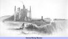
This colliery is situated about a quarter of a mile east from the village of Wallsend. It was begun about 1806, and has been wrought by three shafts, including a water shaft to the Bensham seam. The shaft and engine represented in our view occupy the summit of an eminence overhanging a deep dean, through which a rivulet makes its way to the Tyne near Willington Quay. The shaft is 108 fathoms deep to the thill of the main seam, which is here six feet thick. The Bensham seam is 37 fathoms lower, and is expected to average at least four feet thick; though, where it has been won, it is of even more promising dimensions. For many years, however, this seam remained unworked; and an attempt to open it in 1831 was attended by a fatal accident. In sinking a staple from the High Main or Wallsend seam to the Bensham, an explosion of gas occurred, about nine o'clock in the morning of the 20th of September in that year, by which three men and eight horses were killed on the spot, and other fourteen of the men were severely burnt, four of whom afterwards died in consequence. The whole complement of men were in the colliery at the time of the accident; but the greater part were enabled to effect their escape by means of another shaft, up which they were drawn in time to save their lives. So great was the evolution of gas from the staple, that it was found necessary to arch it over in the manner of a gasometer, and, by a number of pipes, the inflammable air was, for a considerable period, conveyed "to bank," where it was consumed by ignition, in the same manner as at Wallsend. Such, however, have been the improvements effected in the ventilation of the pit, by the sinking of an additional shaft to the Bensham seam, and by other means, that the working of that seam is about to be resumed with increased vigour, and for which preparations are making on an extensive scale.
Views of the Collieries (1844)
|
|
|
|
|
|
|
Disasters (5 or more killed)
None Found
|
|
|
|
|
|
|
Names of those killed at this colliery
Please note that this collection of names is by no means complete!
 | Armstrong, Joseph, 20 Sep 1831, killed in the 1831 explosion [More information ...] | |||||
| Black, George, 01 Jan 1852, fell down the shaft as he was going to work | |||||
|  | Cowell, Thomas, 20 Sep 1831, killed in the 1831 explosion [More information ...] | ||||
| Dodds, John, 31 Jan 1856, aged 60, died from natural causes in the pit | |||||
| Martin, Michael, 20 Sep 1831, killed in the 1831 explosion [More information ...] | |||||
| Nicholls, Thomas, 20 Sep 1831, killed in the 1831 explosion [More information ...] | |||||
| | Twigs, Benjamin, 20 Sep 1831, killed in the 1831 explosion [More information ...] | ||||
| 7 names found | ||||||
If you know of any fatalities missing from the above list then please contact us with the details and we will add them to our database.
Those names marked with ,
have a web page providing individual details of the accident, the page may
also include a photograph of the deceased.
Click on the symbol
next to the name to see the web page.
Some of the names of mining fatalities on this page have been kindly provided by Ian Winstanley of the
Coal Mining History Resource Centre (CMHRC) and are marked with .
The CMHRC is available here.
more information on some of the fatalities shown above
|
|
|
|
|
|
|
Collieries and Pits within 5 miles (8km)
a simulated map showing the immediate vicinity of Willington Colliery (NBL)
list of collieries/pits etc. near to Willington Colliery (NBL)
|
|
|
|
|
|
|
Gallery Images:
|
|
|
|
|
|
|
Credits
Sources:
- An Account of the strata of Northumberland & Durham as proved by Borings & Sinkings, Volume U-Z, published by the North of England Institute of Mining & Mechanical Engineers, 1897
- Local Records or Historical Register of Remarkable Events by John Sykes, published in 1833 in two volumes
- Mineral Statistics for 1855 (Memoirs of the Geological Survey of Great Britain, and of the Museum of Practical Geology), compiled by Robert Hunt, F.R.S.
- Pigot & Co.'s Commercial Directory of Durham, Northumberland and Yorkshire. Published in 1834
- Victoria History of the Counties of England – Durham. Published in three volumes in 1907.
- Views of the Collieries in the Counties of Northumberland and Durham by T. H. Hair. First published in 1844.
Pictures:
- Views of the Collieries in the Counties of Northumberland and Durham by T. H. Hair. First published in 1844.
|
|
|
|
|
|
|
Related Links:
| On this site | |
| | Newspaper articles |
| | Views of the Collieries in the Counties of Northumberland and Durham by T. H. Hair (1844) — Willington Colliery |
| | Evidence given to the 1842 Children's Employment Commission |
| | Pictures in the Gallery section for Willington Colliery |
Further Reading:
- Explosions in Coal Mines by W. N. & J. B. Atkinson, published in 1886
Further Research:
Research Notes for Willington Colliery



 Contains public sector information licensed under the

