Logo Museum
Museum
Friends of Durham Mining Museum
Events Calendar
e-Books and Books for sale
Photograph Gallery
Document Archive
Master Name Index
What's new in the site
Mining
Mining History
Colliery Index
Colliery Index
UK Colliery Index
Shaft cross sections
Borings and Sinkings
List of Mines
Colliery Managers
Abandoned Seams
Colliery Maps
Company Overviews
Who's Who
Mineral Information
Managers Certificates
Educational Material
Bibliography
Statistics
Workers/Employee Lists
Notes for Family Historians
War Service information
Disasters
Disaster Reports
Names of those killed
Disasters in the 1700s
Disasters in the 1800s
Disasters in the 1900s
Memorials
Awards for Gallantry
On this day ...

Links to other sites of interest
Industrial Heritage Days Out
Former www.pitwork.net web site

Index to site

Contact and address details

Share Page with Social Media

Share on Facebook

Share with Reddit

Share on Delicious


  Swinburne Quarry (Whinstone)  Index  Swinburne Quarry (Whinstone)  
/ Index \

Swinburne Quarry (Whinstone)


  Summary Description Disasters Names Local Collieries Credits  

Location: Hexham
7½ miles [12 km] N of Hexham
Map Ref: (Sheet 87) NY946765, 55° 4' 58" N, 2° 5' 5" W
Opened:
Closed:
Owners: 1950s - Amalgamated Roadstone Corporation Ltd.
1980s - ARC
Output: 1984 - Igneous rock.


  Description Summary Disasters Names Local Collieries Credits  

Description


  Disasters Summary Description Names Local Collieries Credits  

Disasters (5 or more killed)

None found.


  Names Summary Description Disasters Local Collieries Credits  

Names of those killed at this colliery

No names found.


  Local Collieries Summary Description Disasters Names Credits  

Collieries and Pits within 5 miles (8km)

Colliery Map  a simulated map showing the immediate vicinity of Swinburne Quarry (Whinstone)

Nearby Collieries  list of collieries/pits etc. near to Swinburne Quarry (Whinstone)


  Summary Description Disasters Names Local Collieries Credits  

Gallery Images:

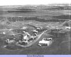
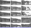
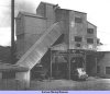
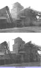
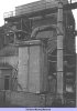
An aerial view of the Swinburne (Northumberland) property of the Amalgamated Roadstone Corporation Limited, showing the siting of the crushing, screening and coating plant in relation to the quarry face workings A series of fifteen photographs taken from a cine-film of a milli-second delay blast at Swinburne Loading into road transport from the coated stone storage hoppers located below the mixer in No. 2 tar plant Comparative photographs showing the plant with and without the dust control equipment in operation View of the wet precipitator used for suppressing dust from the tertiary crushers

  Credits Summary Description Disasters Names Local Collieries  

Credits

Sources:

  • 1984 Directory of Mines & Quarries published by The British Geological Survey

Pictures:

  • Mine & Quarry Engineering

  Summary Description Disasters Names Local Collieries Credits  

Related Links:

On this site
Pictures in the Gallery section for Swinburne Quarry Pictures in the Gallery section for Swinburne Quarry
Article from <I>Mine & Quarry Engineering</I> (July 1954) — "Swinburne Quarry" Article from Mine & Quarry Engineering (July 1954) — "Swinburne Quarry"
mail
Mail:
Webmaster
Back
Back
Home
Home
Open Government Licence   Contains public sector information licensed under the Open Government Licence v3.0.

Copyright © 1999-2024 by The Durham Mining Museum and its contributors
Registered Charity No: 1110608
Page last updated: 31 Dec 2022

Privacy Policy
 
Terms & Conditions
 
Search
Search
Print
Print
A B C D E F G H I J K L M N O P Q R S T U V W X Y Z