


| Fawdon Colliery | Index | Fawdon Colliery | ||
 |

|
 |
||
Fawdon Colliery
 |
 |

|





|
|
|
| Location: | Fawdon 4½ miles [7 km] NNW of Newcastle |
| Map Ref: | (Sheet 88) NZ221702, 55° 1' 33" N, 1° 39' 15" W |
| Opened: | 1810 |
| Closed: | |
| Pits: | A Pit |
| B Pit, opened: 1813 | |
| E Pit, opened: 1823 | |
| Engine Pit, locn: (Sheet 88) NZ227689, sinking: 09 Mar 1810 | |
 Shaft details for Engine Pit |
|
| F Pit, opened: 1836 | |
| Owners: | 1840s - Newmarch, Sons & Co. |
| Seams Worked: | 1844 - High Main |
| Catalogue of plans of abandoned mines for Fawdon Colliery |
|
|
|
|
|
|
|
Description
The township and village of Fawdon is situated about 3½ miles north-by-west from Newcastle, and in the parish of Gosforth. High Fawdon, Fawdon Square, and Low Fawdon, ate pit villages, which owe their existence to the colliery. The A Pit was commenced in March 1810 ; and the High Main coal was reached in May, 1811, at a depth of 48 fathoms. The engine power at this pit is 15 horses ; but it is not now in operation. The B Pit was sunk in the years 1813 and 1814, and is about the same depth as the A Pit. During the sinking a fossil tree was discovered. No coals have been drawn at this pit for many years ; but it is used as a furnace pit for the purpose of ventilation. The E Pit was sunk in the years 1822, 1823, and 1824. Its depth is 51 fathoms, and it is the only pit at the colliery from which coals are now drawn. The engine is of 30 horses power. Another haft, called the F pit, was sunk in the years 1836 and 1837, for the purpose of draining the water, which is got to the dip of the colliery by working pillars. The engine power used for this purpose is 100 horses. The High Main is the only seam which has been worked at this colliery. On September 5, 1827, an explosion of gas took place, by which three young men were much burnt, two of whom died shortly afterwards. The waggons are drawn from the screens by an inclined plane to Kenton-bank-top, or Blakelaw, by means of a fixed engine. The coals are called in the London Markets "Newmarch;s Wallsend," being wrought by the firm of Newmarch, Sons, and Co.
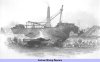
Views of the Collieries (1844)
|
|
|
|
|
|
|
Disasters (5 or more killed)
None found.
|
|
|
|
|
|
|
Names of those killed at this colliery
Please note that this collection of names is by no means complete!

 | Scott, Mark, 02 Feb 1836, aged 49, Overman, fell down shaft | |||||
| Watson, Luke, 11 Apr 1843, aged 20 | |||||
| 2 names found | ||||||
If you know of any fatalities missing from the above list then please contact us with the details and we will add them to our database.
Those names marked with ,
have a web page providing individual details of the accident, the page may
also include a photograph of the deceased.
Click on the symbol
next to the name to see the web page.
|
|
|
|
|
|
|
Collieries and Pits within 5 miles (8km)
a simulated map showing the immediate vicinity of Fawdon Colliery
list of collieries/pits etc. near to Fawdon Colliery
|
|
|
|
|
|
|
Gallery Images:
|
|
|
|
|
|
|
Credits
Sources:
- An Account of the strata of Northumberland & Durham as proved by Borings & Sinkings, Volume F-K, published by the North of England Institute of Mining & Mechanical Engineers, 1885
- Contributions by members of the Public
- Views of the Collieries in the Counties of Northumberland and Durham by T. H. Hair. First published in 1844.
Pictures:
- Views of the Collieries in the Counties of Northumberland and Durham by T. H. Hair. First published in 1844.
|
|
|
|
|
|
|
Related Links:
| On this site | |
| | Newspaper articles |
| | Views of the Collieries in the Counties of Northumberland and Durham by T. H. Hair (1844) — Fawdon Colliery |
| | Evidence given to the 1842 Children's Employment Commission |
| | Pictures in the Gallery section for Fawdon Colliery |
Further Research:
Research Notes for Fawdon Colliery



 Contains public sector information licensed under the

