


|

|

|

|
|
 |
 |
 |
||
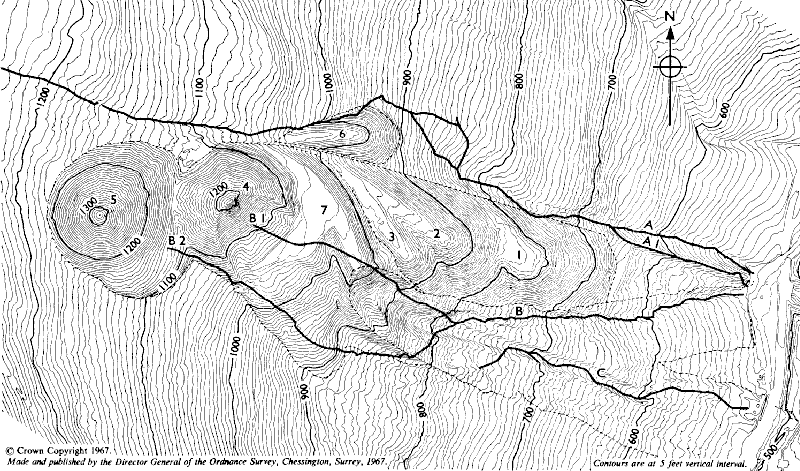
Figure 4 — Contour Map of Tip Complex from aerial photograph, post disaster; showing positions of original streams


|
|
Figure 4 — Contour Map of Tip Complex from aerial photograph, post disaster; showing positions of original streams
|
|||||||||||
 |
 |
 |
||||||

Mail: Webmaster |

Back |

Home |
 Contains public sector information licensed under the
Open Government Licence v3.0. Copyright © 1999-2024 by The Durham Mining Museum and its contributors Registered Charity No: 1110608 Page last updated: 31 Dec 2022
|

Search |

|
|||