


| Thirlwall Colliery | Index | Thirlwall Colliery | ||
 |

|
 |
||
Thirlwall Colliery
 |
 |

|





|
|
|
| Location: | Haltwhistle 14 miles [23 km] NNW of Alston |
||||||||||||||||||||||||||||||||||||||||||||||||||||||
| Map Ref: | (Sheet 86) NY651681, 55° 0' 22" N, 2° 32' 45" W | ||||||||||||||||||||||||||||||||||||||||||||||||||||||
| Opened: | |||||||||||||||||||||||||||||||||||||||||||||||||||||||
| Closed: | 1926 | ||||||||||||||||||||||||||||||||||||||||||||||||||||||
| Owners: | 1910s - Thirlwall Coal Co. Ltd. | ||||||||||||||||||||||||||||||||||||||||||||||||||||||
| 1910s - Mickley Coal Co. Ltd. | |||||||||||||||||||||||||||||||||||||||||||||||||||||||
| Output: | 1905 - Coal. | ||||||||||||||||||||||||||||||||||||||||||||||||||||||
| 1910 - Coal. | |||||||||||||||||||||||||||||||||||||||||||||||||||||||
| 1921 - Coal: Coking, Gas. | |||||||||||||||||||||||||||||||||||||||||||||||||||||||
| 1923 - Coal: Gas, Household, Steam. | |||||||||||||||||||||||||||||||||||||||||||||||||||||||
| 1924 - Coal: Gas, Household, Steam. | |||||||||||||||||||||||||||||||||||||||||||||||||||||||
| 1925 - Coal: Gas, Household, Steam. | |||||||||||||||||||||||||||||||||||||||||||||||||||||||
| Employment: |
|
||||||||||||||||||||||||||||||||||||||||||||||||||||||
 Colliery Management (prior to 1970) | |||||||||||||||||||||||||||||||||||||||||||||||||||||||
| Seams Worked: | 1910 - Limestone Coal | ||||||||||||||||||||||||||||||||||||||||||||||||||||||
| 1915 - Limestone Coal | |||||||||||||||||||||||||||||||||||||||||||||||||||||||
| 1921 - Thirlwall | |||||||||||||||||||||||||||||||||||||||||||||||||||||||
| 1923 - Thirlwall | |||||||||||||||||||||||||||||||||||||||||||||||||||||||
| 1924 - Thirlwall | |||||||||||||||||||||||||||||||||||||||||||||||||||||||
| 1925 - Thirlwall | |||||||||||||||||||||||||||||||||||||||||||||||||||||||
| Catalogue of plans of abandoned mines for Thirlwall Colliery |
|||||||||||||||||||||||||||||||||||||||||||||||||||||||
| Notes: | 1926 - Thirlwall seam abandoned |
||||||||||||||||||||||||||||||||||||||||||||||||||||||



|
|
|
|
|
|
|
Description
|
|
|
|
|
|
|
Disasters (5 or more killed)
None found.
|
|
|
|
|
|
|
Names of those killed at this colliery
No names found.
|
|
|
|
|
|
|
Collieries and Pits within 5 miles (8km)
a simulated map showing the immediate vicinity of Thirlwall Colliery
list of collieries/pits etc. near to Thirlwall Colliery
|
|
|
|
|
|
|
Gallery Images:
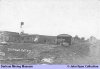
|
|
|
|
|
|
|
Credits
Sources:
- 1905 List of Mines - Government report from the Mines Department
- 1910 List of Mines - Government report from the Mines Department
- 1915 List of Mines - Government report from the Mines Department
- 1921 List of Mines - Government report from the Mines Department
- 1923 List of Mines - Government report from the Mines Department
- 1924 List of Mines - Government report from the Mines Department
- 1925 List of Mines - Government report from the Mines Department
- Industrial Locomotives of Northumberland by The Industrial Railway Society, compiled by Colin E. Mountford and L. G. Charlton, published in 1983
Pictures:
- Colliery picture provided by David Kitching from the John Ryan Collection (©)
|
|
|
|
|
|
|
Related Links:
| On this site | |
| | Pictures in the Gallery section for Thirlwall Colliery |



 Contains public sector information licensed under the

