


|
| |
Stanhope Burn (Lead Ore) |
Index |
Stanhope Burn (Lead Ore) |
|
 |

|
 |
Stanhope Burn (Lead Ore)
| Location: |
Stanhope
14½ miles [24 km] SSE of Hexham
|
| Map Ref: |
(Sheet 87) NY987412, 54° 45' 56" N, 2° 1' 13" W |
| Maps: |
 1952 map Lead mines of the Northern Dales |
| Opened: |
|
| Closed: |
|
| Owners: |
1800's - London Lead Co. |
|
1880s - W. B. Beaumont |
|
1890s - Weardale Lead Mining Co. Ltd. |
|
1910s - Weardale Lead Co. Ltd. |
|
1940s - Flourspar Ltd. |
| Output: |
1882 - Lead Ore. |
|
1883 - Lead Ore. |
|
1884 - Lead Ore. |
|
1888 - Lead Ore. |
|
1890 - Lead Ore. |
|
1894 - Lead Ore. |
|
1896 - Lead Ore. |
|
1900 - Lead Ore. |
|
1902 - Lead Ore. |
|
1905 - Lead ore. |
|
1910 - Lead ore and flour spar. |
|
1915 - Lead ore and fluor spar. |
|
1921 - Lead Ore, Fluorspar. |
|
1923 - Lead Ore, Fluorspar. |
|
1924 - Lead Ore, Fluorspar. |
|
1925 - Lead Ore, Fluorspar. |
|
1927 - Lead Ore, Fluorspar. |
|
1929 - Lead Ore, Fluorspar. |
|
1930 - Lead Ore, Fluorspar. |
|
1945 - Fluorspar. |
|
1950 - Fluorspar. |
|
1979 - Fluorspar. |
|
1980 - Fluorspar. |
|
1983 - Fluorspar. |
| |
Detailed Mineral Statistics for Stanhope Burn (Lead Ore) |
| Employment: |
1894 - 0 [Standing] |
|
1896 - 0 [Standing] |
|
1900 - 0 [Standing] |
|
1902 - 0 [Standing] |
|
1905 - 0 [Not worked] |
|
1910 - 75 (43 below, 32 surface) |
|
1915 - 64 (34 below, 30 surface) |
|
1921 - 28 (14 below, 14 surface) |
|
1923 - 23 (19 below, 4 surface) |
|
1924 - 22 (18 below, 4 surface) |
|
1925 - 21 (17 below, 4 surface) |
|
1927 - 22 (19 below, 3 surface) |
|
1929 - 9 (6 below, 3 surface) |
|
1930 - 12 (8 below, 4 surface) |
|
1945 - 29 (18 below, 11 surface) |
|
1950 - 79 (34 below, 45 surface) |
|
Colliery Management (prior to 1970)
|
| |
Catalogue of plans of abandoned mines for Stanhope Burn (Lead Ore) |
Description
Disasters (5 or more killed)
None found.
Names of those killed at this colliery
Please note that this collection of names is by no means complete!
| | |  | | | | Charlton, John, 15 Jul 1873, aged 17, Labourer, supposed to have got entangled in the rope and drawn into the drum |
| | | | | | | Gibson, Joseph, 26 Sep 1873, aged 28, Engine Fireman, while strapping an iron ore waggon |
| | | | | | | Wilkinson, Thomas, 06 Jun 1873, aged 47, Iron Ore Miner, killed by a fall of stone from the roof of the drift |
| |
| |
3 names found |
If you know of any fatalities missing from the above list then please
contact us
with the details and we will add them to our database.
Those names marked with ,
have a web page providing individual details of the accident, the page may
also include a photograph of the deceased.
Click on the symbol
next to the name to see the web page.
Collieries and Pits within 5 miles (8km)
a simulated map showing the immediate vicinity of Stanhope Burn (Lead Ore)
list of collieries/pits etc. near to Stanhope Burn (Lead Ore)
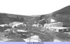
Gallery Images:
Credits
Sources:
- 1873 Mines Inspectors Report (C. 1056), Anglesey, Brecon, Cardigan, etc. District by T. Fanning Evans, H.M. Inspector of Mines Where to find this report
- 1881 Mines Inspectors Report (C 3241)
- 1888 List of Mines - Government report from the Mines Department
- 1890 List of Mines - Government report from the Mines Department
- 1894 List of Mines - Government report from the Mines Department
- 1896 List of Mines - Government report from the Mines Department, also available online at Peak District Mines Historical Society Ltd
- 1900 List of Mines - Government report from the Mines Department
- 1902 List of Mines - Government report from the Mines Department
- 1905 List of Mines - Government report from the Mines Department
- 1910 List of Mines - Government report from the Mines Department
- 1915 List of Mines - Government report from the Mines Department
- 1921 List of Mines - Government report from the Mines Department
- 1923 List of Mines - Government report from the Mines Department
- 1924 List of Mines - Government report from the Mines Department
- 1925 List of Mines - Government report from the Mines Department
- 1927 List of Mines - Government report from the Mines Department
- 1929 List of Mines - Government report from the Mines Department
- 1930 List of Mines - Government report from the Mines Department
- 1945 List of Mines - Government report from the Mines Department
- 1950 List of Mines - Government report from the Mines Department
- 1979 Guide to the Coalfields published by the Colliery Guardian
- 1980 Guide to the Coalfields published by the Colliery Guardian
- 1983 Guide to the Coalfields published by the Colliery Guardian
- Mineral Statistics for 1883 - Government report from the Mines Department (C 4058), published in 1884 — includes List of Mines and Mineral Works
- Mineral Statistics for 1884 - Government report from the Mines Department (C 4430), published in 1885 — includes List of Mines and Openworks
Related Links:
| On this site |
| | Newspaper articles |
| | Pictures in the Gallery section for Stanhope Burn |
| | Article from Mine & Quarry Engineering (April 1953) — "A Fluorspar Producer in County Durham" |
Further Reading:
- British Small Mines (North) by A. J. Booth, published in 2000 by Industrial Railway Society, ISBN 1 901556 15 8
|
|










 Contains public sector information licensed under the

