


| Rotherhope Fell (Lead Ore) | Index | Rotherhope Fell (Lead Ore) | ||
 |

|
 |
||
Rotherhope Fell (Lead Ore)
also known as Rodderup Fell (Lead Ore)
 |
 |

|





|
|
|
| Location: | Rotherhope Fell 2½ miles [4 km] SSW of Alston |
| Map Ref: | (Sheet 86, 87) NY701428, 54° 46' 45" N, 2° 27' 54" W |
| Maps: |  1860s map detailed map from the Ordnance Survey |
| Opened: | |
| Closed: | |
| Pits: | Shaft details for Rotherhope Fell (Lead Ore) |
| Owners: | 1890s - Rodderup Fell Lead Mining Co. |
| 1900s - Vieille Montagne Zinc Co. | |
| 1950s - Anglo Austral Mines Ltd. | |
| Output: | 1882 - Lead Ore. |
| 1883 - Lead ore. | |
| 1888 - Lead Ore. | |
| 1890 - Lead Ore. | |
| 1894 - Lead Ore. | |
| 1896 - Lead Ore. | |
| 1900 - Lead Ore ; Zinc Ore. | |
| 1902 - Lead Ore. | |
| 1905 - Lead ore. | |
| 1910 - Lead ore. | |
| 1915 - Lead ore. | |
| 1921 - Lead Ore. | |
| 1923 - Lead Ore. | |
| 1924 - Lead Ore. | |
| 1925 - Lead Ore. | |
| 1927 - Lead Ore. | |
| 1929 - Lead Ore. | |
| 1930 - Lead Ore. | |
| 1935 - Lead Ore. | |
| 1945 - Fluorspar, Lead Ore, Limestone. | |
| 1950 - Fluorspar, Lead Ore. | |
| Detailed Mineral Statistics for Rotherhope Fell (Lead Ore) |
|
| Employment: | 1894 - 14 (11 below, 3 surface) |
| 1896 - 16 (8 below, 8 surface) | |
| 1900 - 35 (16 below, 19 surface) | |
| 1902 - 23 (18 below, 5 surface) | |
| 1905 - 11 (10 below, 1 surface) | |
| 1910 - 19 (15 below, 4 surface) | |
| 1915 - 12 (6 below, 6 surface) | |
| 1921 - 18 (14 below, 4 surface) | |
| 1923 - 32 (23 below, 9 surface) | |
| 1924 - 43 (26 below, 17 surface) | |
| 1925 - 45 (25 below, 20 surface) | |
| 1927 - 85 (44 below, 41 surface) | |
| 1929 - 88 (45 below, 43 surface) | |
| 1930 - 63 (38 below, 25 surface) [Closed down 12/30] | |
| 1935 - 25 (7 below, 18 surface) | |
| 1945 - 17 (8 below, 9 surface) | |
| 1950 - 2 | |
| Colliery Management (prior to 1970)
| |
| Catalogue of plans of abandoned mines for Rotherhope Fell (Lead Ore) |
|
| Notes: | 1930 - Operations on a large scale ceased, pumps kept going |
1934, Nov - Mine closed |
|
1935, Oct - Mine reopened |
|
| Miscellaneous Notes and Incidents for Rotherhope Fell (Lead Ore) |
|
|
|
|
|
|
|
Description
|
|
|
|
|
|
|
Disasters (5 or more killed)
None found.
|
|
|
|
|
|
|
Names of those killed at this colliery
Please note that this collection of names is by no means complete!

 |  | Craig, William, 08 May 1852, (accident: 07 May 1852), aged 20, killed by a fall of stone | ||||
| | Dickinson, James, 18 Dec 1839, aged 54, killed by the fall of a large quantity of earth from the roof of the drift | ||||
| | Palmerby, Thomas, 15 Apr 1837, aged 45, Miner, killed by a fall of earth, left a wife and twelve children | ||||
| | Walton, William, 04 Mar 1834, aged 22, Miner, killed by a fall of roof | ||||
| 4 names found | ||||||
If you know of any fatalities missing from the above list then please contact us with the details and we will add them to our database.
Those names marked with ,
have a web page providing individual details of the accident, the page may
also include a photograph of the deceased.
Click on the symbol
next to the name to see the web page.
Some of the names of mining fatalities on this web page have been kindly provided by
The West Cumbria Mines Research
and are marked with .
|
|
|
|
|
|
|
Collieries and Pits within 5 miles (8km)
a simulated map showing the immediate vicinity of Rotherhope Fell (Lead Ore)
list of collieries/pits etc. near to Rotherhope Fell (Lead Ore)
|
|
|
|
|
|
|
Gallery Images:
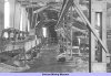
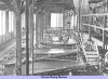
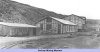
|
|
|
|
|
|
|
Credits
Sources:
- 1881 Mines Inspectors Report (C 3241)
- 1888 List of Mines - Government report from the Mines Department
- 1890 List of Mines - Government report from the Mines Department
- 1894 List of Mines - Government report from the Mines Department
- 1896 List of Mines - Government report from the Mines Department, also available online at Peak District Mines Historical Society Ltd
- 1900 List of Mines - Government report from the Mines Department
- 1902 List of Mines - Government report from the Mines Department
- 1905 List of Mines - Government report from the Mines Department
- 1910 List of Mines - Government report from the Mines Department
- 1915 List of Mines - Government report from the Mines Department
- 1921 List of Mines - Government report from the Mines Department
- 1923 List of Mines - Government report from the Mines Department
- 1924 List of Mines - Government report from the Mines Department
- 1925 List of Mines - Government report from the Mines Department
- 1927 List of Mines - Government report from the Mines Department
- 1929 List of Mines - Government report from the Mines Department
- 1930 List of Mines - Government report from the Mines Department
- 1935 List of Mines - Government report from the Mines Department
- 1945 List of Mines - Government report from the Mines Department
- 1950 List of Mines - Government report from the Mines Department
- Information supplied by West Cumbria Mines Research
- Mineral Statistics for 1883 - Government report from the Mines Department (C 4058), published in 1884 — includes List of Mines and Mineral Works
|
|
|
|
|
|
|
Related Links:
| On this site | |
| | Newspaper articles |
| | Pictures in the Gallery section for Rotherhope Fell |



 Contains public sector information licensed under the

