


|
| |
New Shildon Colliery |
Index |
New Shildon Colliery |
|
 |

|
 |
New Shildon Colliery
| Location: |
Shildon
11 miles [18 km] SSW of Durham
|
| Map Ref: |
(Sheet 93) NZ220256, 54° 37' 30" N, 1° 39' 33" W |
| Maps: |
 1951 map from the Guide to the Coalfields (Colliery Guardian) |
| Opened: |
1949 |
| Closed: |
Aug 1965 |
| Owners: |
1947 - National Coal Board (N.C.B.) |
| Output: |
1894 - Coal: Manufacturing. |
|
1950 - Coal. |
|
1955 - Coal: Coking, Household, Manufacturing. |
|
1960 - Coal: Coking, Household, Manufacturing. |
|
1961 - Coal: Coking, Household, Manufacturing. |
|
1964 - Coal: Coking, Gas, Household, Industrial, Steam. |
|
1965 - Coal: Coking, Gas, Household, Industrial, Steam. |
|
1974 - Coal: Household, Industrial. |
|
1975 - Coal: Household, Industrial. |
|
1976 - Coal: Household, Industrial. |
|
1977 - Coal: Household, Industrial. |
|
1979 - Coal: Household, Industrial. |
|
1980 - Coal: Household, Industrial. |
|
1981 - Coal: Household, Industrial. |
| Employment: |
| Year | Pit | Total |  | Below | Above |
|---|
| 1894 | | 242 |   | 205 | 37 |
| 1950 | | inc. in Princes St. |
| 1955 | | 247 | | 189 | 58 |
| 1960 | | 536 | | 439 | 97 |
| 1961 | | 530 | | 460 | 70 |
| 1964 | | 516 | | 459 | 57 |
| 1965 | | 407 | | 355 | 52 |
| 1975 | | 17 | | 14 | 3 |
| 1976 | | 13 | | 10 | 3 |
| 1977 | | 12 | | 9 | 3 |
| 1979 | | 14 | | 10 | 4 |
| 1980 | | 13 | | 9 | 4 |
| 1981 | | 13 | | 9 | 4 |
|
|
NCB Employment Figures
|
| Seams Worked: |
1950 - Low Main |
|
1955 - Hutton, Low Main |
|
1960 - Hutton, Low Main |
|
1961 - Hutton, Low Main |
|
1964 - Hutton, Low Main |
|
1965 - Hutton, Low Main |
|
1974 - Brass Thill |
|
1975 - Brass Thill |
|
1976 - Brass Thill |
|
1977 - Brass Thill |
|
1979 - Brass Thill |
|
1980 - Brass Thill |
|
1981 - Brass Thill |
| |
Catalogue of plans of abandoned mines for New Shildon Colliery |
| Notes: |
1885 - An upover staple was driven from the Busty to the Harvey Seam, New Shildon Colliery. |
|
1889 - Brockwell seam abandoned - Worked out. |
|
1892, May - Busty Seam abandoned for an indefinite period in consequence of the damage done to the mine by the late strike and the general depression of trade |
Description
Disasters (5 or more killed)
None found.
Names of those killed at this colliery
No names found.
Collieries and Pits within 5 miles (8km)
a simulated map showing the immediate vicinity of New Shildon Colliery
list of collieries/pits etc. near to New Shildon Colliery
Gallery Images:
Credits
Sources:
- 1894 List of Mines - Government report from the Mines Department
- 1950 List of Mines - Government report from the Mines Department
- 1955 Guide to the Coalfields published by the Colliery Guardian
- 1960 Guide to the Coalfields published by the Colliery Guardian
- 1961 Guide to the Coalfields published by the Colliery Guardian
- 1964 Guide to the Coalfields published by the Colliery Guardian
- 1965 Guide to the Coalfields published by the Colliery Guardian
- 1974 Guide to the Coalfields published by the Colliery Guardian
- 1975 Guide to the Coalfields published by the Colliery Guardian
- 1976 Guide to the Coalfields published by the Colliery Guardian
- 1977 Guide to the Coalfields published by the Colliery Guardian
- 1979 Guide to the Coalfields published by the Colliery Guardian
- 1980 Guide to the Coalfields published by the Colliery Guardian
- 1981 Guide to the Coalfields published by the Colliery Guardian
- 1985/6 Guide to the Coalfields published by the Colliery Guardian
- Banners of the Durham Coalfield, Norman Emery, 1998, Sutton Publishing Ltd., ISBN 0-7509-1708-3
- History, Topography, and Directory of the County Palatine of Durham by Francis Whellan. Second edition published in 1894.
- Victoria History of the Counties of England – Durham. Published in three volumes in 1907.
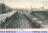
- Colliery picture provided by David Kitching from the John Ryan Collection (©)
Related Links:
| On this site |
| | Pictures in the Gallery section for New Shildon Colliery |
Further Reading:
- Banners of the Durham Coalfield, Norman Emery, 1998, Sutton Publishing Ltd., ISBN 0-7509-1708-3, provides a brief history of the colliery along with the history of the associated Miners Lodge Banner
Further Research:
Research Notes for New Shildon Colliery
|
|










 Contains public sector information licensed under the

