


| Boltsburn (Lead Ore) | Index | Boltsburn (Lead Ore) | ||
 |

|
 |
||
Boltsburn (Lead Ore)
 |
 |

|





|
|
|
| Location: | Rookhope 13½ miles [22 km] S of Hexham |
||||||||||||||||||||||||||||||||||||||||||||||||||||||||||||||||||||||||||||||||||||||||||||||||||||||||||||||||||
| Map Ref: | (Sheet 87) NY937426, 54° 46' 43" N, 2° 5' 52" W | ||||||||||||||||||||||||||||||||||||||||||||||||||||||||||||||||||||||||||||||||||||||||||||||||||||||||||||||||||
| Maps: |  1952 map Lead mines of the Northern Dales |
||||||||||||||||||||||||||||||||||||||||||||||||||||||||||||||||||||||||||||||||||||||||||||||||||||||||||||||||||
| Opened: | |||||||||||||||||||||||||||||||||||||||||||||||||||||||||||||||||||||||||||||||||||||||||||||||||||||||||||||||||||
| Closed: | |||||||||||||||||||||||||||||||||||||||||||||||||||||||||||||||||||||||||||||||||||||||||||||||||||||||||||||||||||
| Pits: | Engine Shaft, locn: (Sheet 87) NY938426 | ||||||||||||||||||||||||||||||||||||||||||||||||||||||||||||||||||||||||||||||||||||||||||||||||||||||||||||||||||
| Shaft details for Engine Shaft |
|||||||||||||||||||||||||||||||||||||||||||||||||||||||||||||||||||||||||||||||||||||||||||||||||||||||||||||||||||
| Shaft details for Boltsburn (Lead Ore) |
|||||||||||||||||||||||||||||||||||||||||||||||||||||||||||||||||||||||||||||||||||||||||||||||||||||||||||||||||||
| Owners: | 1880s - Weardale Lead Mining Co. Ltd. | ||||||||||||||||||||||||||||||||||||||||||||||||||||||||||||||||||||||||||||||||||||||||||||||||||||||||||||||||||
| 1910s - Weardale Lead Co. Ltd. | |||||||||||||||||||||||||||||||||||||||||||||||||||||||||||||||||||||||||||||||||||||||||||||||||||||||||||||||||||
| Output: | 1883 - Lead Ore. | ||||||||||||||||||||||||||||||||||||||||||||||||||||||||||||||||||||||||||||||||||||||||||||||||||||||||||||||||||
| 1884 - Lead Ore. | |||||||||||||||||||||||||||||||||||||||||||||||||||||||||||||||||||||||||||||||||||||||||||||||||||||||||||||||||||
| 1888 - Lead Ore. | |||||||||||||||||||||||||||||||||||||||||||||||||||||||||||||||||||||||||||||||||||||||||||||||||||||||||||||||||||
| 1890 - Lead Ore. | |||||||||||||||||||||||||||||||||||||||||||||||||||||||||||||||||||||||||||||||||||||||||||||||||||||||||||||||||||
| 1894 - Lead Ore. | |||||||||||||||||||||||||||||||||||||||||||||||||||||||||||||||||||||||||||||||||||||||||||||||||||||||||||||||||||
| 1896 - Lead Ore. | |||||||||||||||||||||||||||||||||||||||||||||||||||||||||||||||||||||||||||||||||||||||||||||||||||||||||||||||||||
| 1900 - Lead Ore. | |||||||||||||||||||||||||||||||||||||||||||||||||||||||||||||||||||||||||||||||||||||||||||||||||||||||||||||||||||
| 1902 - Lead Ore. | |||||||||||||||||||||||||||||||||||||||||||||||||||||||||||||||||||||||||||||||||||||||||||||||||||||||||||||||||||
| 1910 - Lead ore and fluor spar. | |||||||||||||||||||||||||||||||||||||||||||||||||||||||||||||||||||||||||||||||||||||||||||||||||||||||||||||||||||
| 1915 - Lead ore and fluor spar. | |||||||||||||||||||||||||||||||||||||||||||||||||||||||||||||||||||||||||||||||||||||||||||||||||||||||||||||||||||
| 1921 - Lead Ore, Fluorspar. | |||||||||||||||||||||||||||||||||||||||||||||||||||||||||||||||||||||||||||||||||||||||||||||||||||||||||||||||||||
| 1925 - Lead Ore, Fluorspar. | |||||||||||||||||||||||||||||||||||||||||||||||||||||||||||||||||||||||||||||||||||||||||||||||||||||||||||||||||||
| 1930 - Lead Ore, Fluorspar, Gravel. | |||||||||||||||||||||||||||||||||||||||||||||||||||||||||||||||||||||||||||||||||||||||||||||||||||||||||||||||||||
| 1934 - Lead Ore. | |||||||||||||||||||||||||||||||||||||||||||||||||||||||||||||||||||||||||||||||||||||||||||||||||||||||||||||||||||
| 1935 - Lead Ore. | |||||||||||||||||||||||||||||||||||||||||||||||||||||||||||||||||||||||||||||||||||||||||||||||||||||||||||||||||||
| 1936 - Lead Ore. | |||||||||||||||||||||||||||||||||||||||||||||||||||||||||||||||||||||||||||||||||||||||||||||||||||||||||||||||||||
| 1938 - Lead Ore. | |||||||||||||||||||||||||||||||||||||||||||||||||||||||||||||||||||||||||||||||||||||||||||||||||||||||||||||||||||
| 1945 - Lead Ore. | |||||||||||||||||||||||||||||||||||||||||||||||||||||||||||||||||||||||||||||||||||||||||||||||||||||||||||||||||||
| 1950 - Lead Ore. | |||||||||||||||||||||||||||||||||||||||||||||||||||||||||||||||||||||||||||||||||||||||||||||||||||||||||||||||||||
| Detailed Mineral Statistics for Boltsburn (Lead Ore) |
|||||||||||||||||||||||||||||||||||||||||||||||||||||||||||||||||||||||||||||||||||||||||||||||||||||||||||||||||||
| Employment: |
|
||||||||||||||||||||||||||||||||||||||||||||||||||||||||||||||||||||||||||||||||||||||||||||||||||||||||||||||||||
| Colliery Management (prior to 1970)
| |||||||||||||||||||||||||||||||||||||||||||||||||||||||||||||||||||||||||||||||||||||||||||||||||||||||||||||||||||
| Catalogue of plans of abandoned mines for Boltsburn (Lead Ore) |
|||||||||||||||||||||||||||||||||||||||||||||||||||||||||||||||||||||||||||||||||||||||||||||||||||||||||||||||||||
| Notes: | Miscellaneous Notes and Incidents for Boltsburn (Lead Ore) |
||||||||||||||||||||||||||||||||||||||||||||||||||||||||||||||||||||||||||||||||||||||||||||||||||||||||||||||||||



|
|
|
|
|
|
|
Description
Boltsburn is another village which derives its name from a burn or stream running at right angles to Rookhope Burn. Rookhope Burn joins the Wear at Eastgate. The principal employment of the inhabitants of this parish is farming, lead-mining, quarrying, and the railway of the Weardale Coal and Iron Company. The lead mining is carried on by the Weardale Lead Company, who have mines situated at Boltsburn and Groverake in this parish [Rookhope], and others in the parishes of Westgate and Heatherycleuch. The railway of the Weardale Coal and Iron Company runs from Park Head, in the parish of Stanhope, where it joins the North-Eastern line, through Rookhope, to Westgate, and is used for the conveyance of coal, limestone, lead, &c. Coal for the village, smelt-mill, and Westgate; limestone from the quarry of the Weardale Coal and Iron Company to their iron-works, and lead from the mines to the smelt-mill, and thence to the market.
Whellan's 1894 Directory of County Durham
|
|
|
|
|
|
|
Disasters (5 or more killed)
None Found
|
|
|
|
|
|
|
Names of those killed at this colliery
Please note that this collection of names is by no means complete!
 | Adamson, Joseph, 18 Dec 1905, aged 60, Labourer, died from heart failure [fatality reported during the year but not classified as a reportable accident] | |||||
| Pearson, James, 22 Oct 1907, aged 19, Lead ore dresser, the bolts holding the drawbar to the body of a tub being hauled up to the dirt tip broke, and allowed the tub to run wild down the incline; it struck him and he died three hours afterwards from the injuries received [More information ...] | |||||
| Wall, Thomas, 05 Jul 1898, aged 16, Pumping Water, when travelling out-bye from his work, a piece of stone fell from the roof of the level and killed him | |||||
| Ward, Watson, 15 Mar 1905, aged 44, Fitter & Banksman, deceased was riding up a shaft 53 feet deep, in which riding was prohibited; the cage was taken up against the pulley and deceased fell to shaft bottom; the top of his head was knocked in [More information ...] | |||||
| 4 names found | ||||||
If you know of any fatalities missing from the above list then please contact us with the details and we will add them to our database.
Those names marked with ,
have a web page providing individual details of the accident, the page may
also include a photograph of the deceased.
Click on the symbol
next to the name to see the web page.
more information on some of the fatalities shown above
|
|
|
|
|
|
|
Collieries and Pits within 5 miles (8km)
a simulated map showing the immediate vicinity of Boltsburn (Lead Ore)
list of collieries/pits etc. near to Boltsburn (Lead Ore)
|
|
|
|
|
|
|
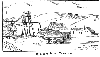
Gallery Images:
|
|
|
|
|
|
|
Credits
Sources:
- 1888 List of Mines - Government report from the Mines Department
- 1890 List of Mines - Government report from the Mines Department
- 1894 List of Mines - Government report from the Mines Department
- 1896 List of Mines - Government report from the Mines Department, also available online at Peak District Mines Historical Society Ltd
- 1898 Mines Inspectors Report (C 9264), Durham District (No. 4) by R. D. Bain, H.M. Inspector of Mines Where to find this report
- 1900 List of Mines - Government report from the Mines Department
- 1902 List of Mines - Government report from the Mines Department
- 1905 List of Mines - Government report from the Mines Department
- 1905 Mines Inspectors Report (Cd 2910), Durham District (No. 4) by R. Donald Bain, H.M. Inspector of Mines Where to find this report
- 1907 Mines Inspectors Report (Cd 4045), Durham District (No. 4) by R. D. Bain, H.M. Inspector of Mines Where to find this report
- 1910 List of Mines - Government report from the Mines Department
- 1915 List of Mines - Government report from the Mines Department
- 1921 List of Mines - Government report from the Mines Department
- 1925 List of Mines - Government report from the Mines Department
- 1930 List of Mines - Government report from the Mines Department
- 1934 List of Mines - Government report from the Mines Department
- 1935 List of Mines - Government report from the Mines Department
- 1936 List of Mines - Government report from the Mines Department
- 1938 List of Mines - Government report from the Mines Department
- 1945 List of Mines - Government report from the Mines Department
- 1950 List of Mines - Government report from the Mines Department
- An Account of the strata of Northumberland & Durham as proved by Borings & Sinkings, Supplement, published by the North of England Institute of Mining & Mechanical Engineers, 1910
- History, Topography, and Directory of the County Palatine of Durham by Francis Whellan. Second edition published in 1894.
- Mineral Statistics for 1883 - Government report from the Mines Department (C 4058), published in 1884 — includes List of Mines and Mineral Works
- Mineral Statistics for 1884 - Government report from the Mines Department (C 4430), published in 1885 — includes List of Mines and Openworks
|
|
|
|
|
|
|
Related Links:
| On this site | |
| | Extracts from Bargain Books relating to Boltsburn — kindly provided by John Stark |
| | Pictures in the Gallery section for Boltsburn |
Further Research:
Research Notes for Boltsburn (Lead Ore)



 Contains public sector information licensed under the

