


| Borings |

|
Index |

|
Borings |
 |
 |
|||
| An Account of the Strata of Northumberland and Durham | Volume: U-Z, Page: 192 |
No. 2,293 — Witton Park
Township of Witton-le-Wear, Durham
Sheet 41 of 19thC Ordnance Map. Lat. , Long. .
Fourth Place bored near Witton Castle, about 100 yards to the South from the Third Place. March 21st, 1757
Approximate surface level feet above sea (Ordnance datum)
 Larger image of entry
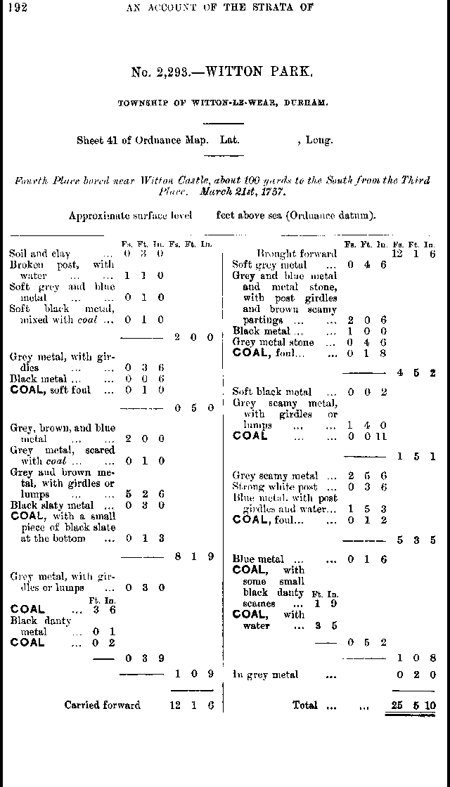
| Source: | An Account of the strata of Northumberland & Durham as proved by Borings & Sinkings, Volume U-Z, published by the North of England Institute of Mining & Mechanical Engineers, 1897 |
Additional Links
| | A graphical representation of this entry |
| 19th Century Mapping | |
| | List of other entries on Durham Sheet 41 |
 |
||
 |
 |
 |




 Contains public sector information licensed under the

