


| Borings |

|
Index |

|
Borings |
 |
 |
|||
| An Account of the Strata of Northumberland and Durham | Volume: L-R, Page: 134 |
No. 1,405 — Nettlesworth
Township of Plawsworth, Durham
Sheet 19 of 19thC Ordnance Map. Lat. , Long. .
Strata bored through in the second hole, 150 yards South-east from the Farm House, Nettlesworth Estate, at the South-east corner, near the Burn
Approximate surface level feet above sea (Ordnance datum)
 Larger image of entry
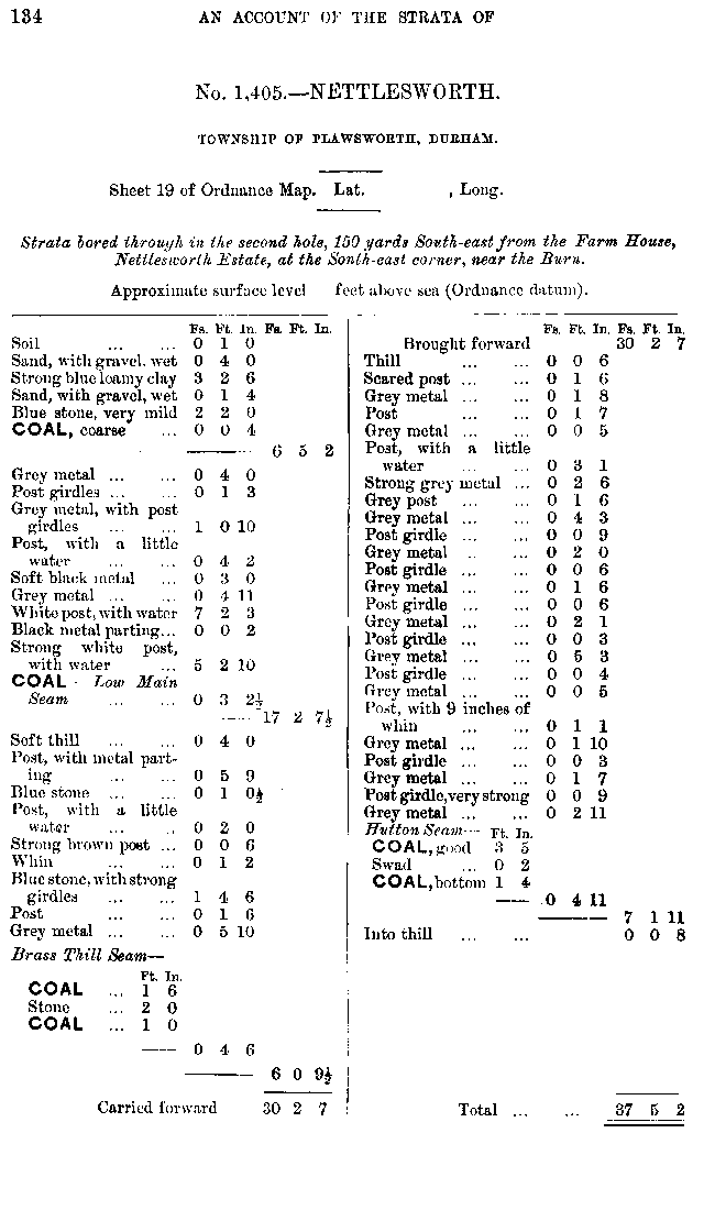
| Source: | An Account of the strata of Northumberland & Durham as proved by Borings & Sinkings, Volume L-R, published by the North of England Institute of Mining & Mechanical Engineers, 1887 |
Additional Links
| | A graphical representation of this entry |
| 19th Century Mapping | |
| | List of other entries on Durham Sheet 19 |
 |
||
 |
 |
 |




 Contains public sector information licensed under the

