


| Borings |

|
Index |

|
Borings |
 |
 |
|||
| An Account of the Strata of Northumberland and Durham | Volume: C-E, Page: 153 |
No. 608 — Coxhoe
Township of Coxhoe, Durham
Sheet 35 of 19thC Ordnance Map. Lat. 54° 42' 59", Long. 1° 30' 31".
[ OS Grid Ref: NZ 31652 35832 (431652,535832) ]
Boring in Coxhoe Royalty, in Mr. Field's Brickyard, West of the Railway Tavern. Left off March 31st, 1864
Approximate surface level 305 feet above sea (Ordnance datum)
 Larger image of entry
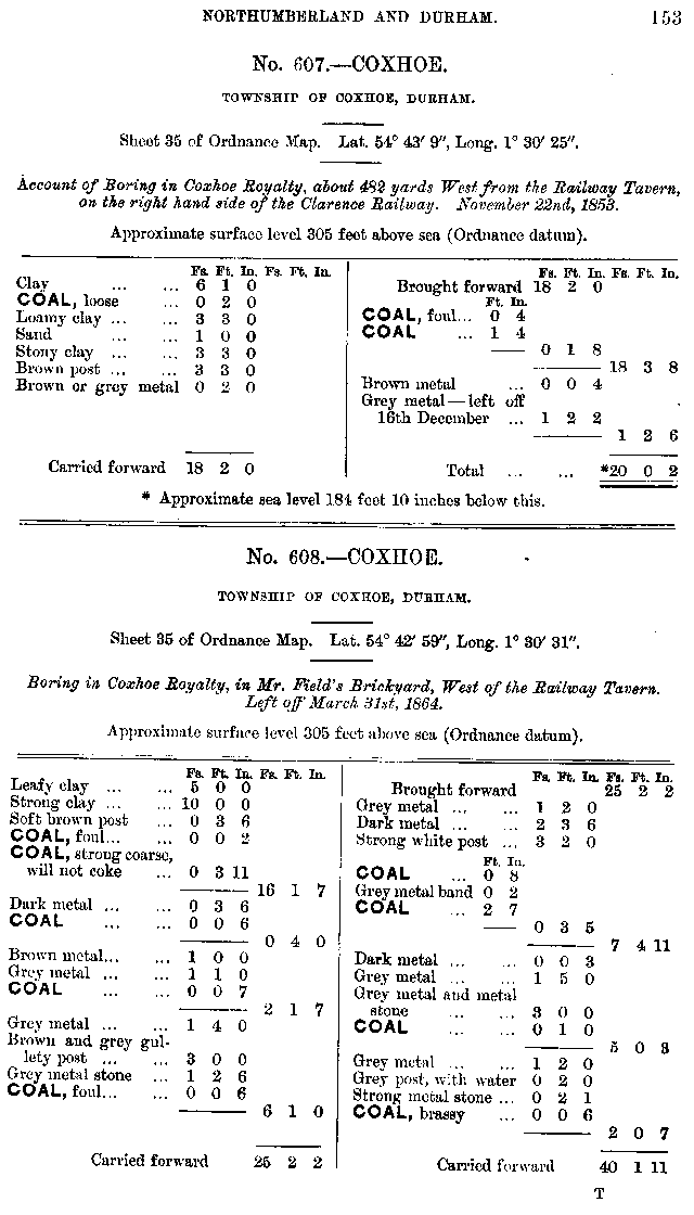
| Source: | An Account of the strata of Northumberland & Durham as proved by Borings & Sinkings, Volume C-E, published by the North of England Institute of Mining & Mechanical Engineers, 1881 |
Nearby Borings
Additional Links
| | A graphical representation of this entry |
| 19th Century Mapping | |
| | List of other entries on Durham Sheet 35 |
 | Location on 1st Series OS Map [www.old-maps.co.uk] |
| 20th Century Mapping | |
| | List of other entries on Landranger Sheet 93 (Middlesbrough, Darlington & Hartlepool) |
| | List of other entries on Detail Sheet NZ33 |
| | Location on current map [www.streetmap.co.uk] |
 |
||
 |
 |
 |




 Contains public sector information licensed under the

