


| Borings |

|
Index |

|
Borings |
 |
 |
|||
| An Account of the Strata of Northumberland and Durham | Volume: A-B, Page: 179 |
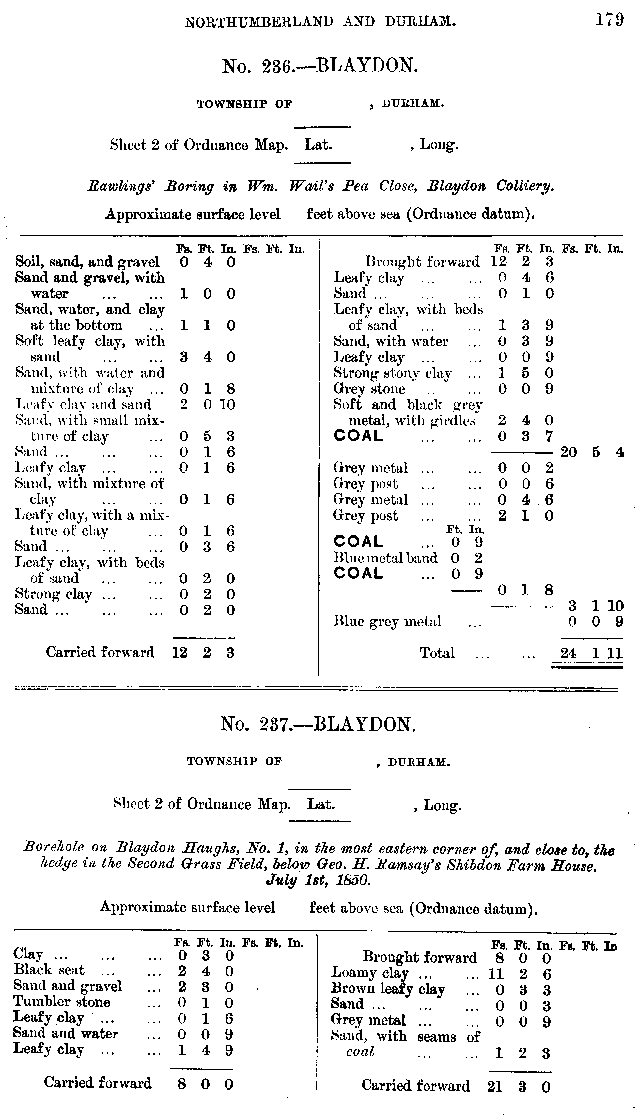
No. 237 — Blaydon
Township of , Durham
Sheet 2 of 19thC Ordnance Map. Lat. , Long. .
Bore hole on Blaydon Haughs, No. 1, in the most eastern corner of, and close to, the hedge in the Second Grass Field, below Geo. H. Ramsay's Shibdon Farm House. July 1st, 1850
Approximate surface level feet above sea (Ordnance datum)
 Larger image of entry
| Source: | An Account of the strata of Northumberland & Durham as proved by Borings & Sinkings, Volume A-B, published by the North of England Institute of Mining & Mechanical Engineers, 1878 |
Additional Links
| | A graphical representation of this entry |
| 19th Century Mapping | |
| | List of other entries on Durham Sheet 2 |
 |
||
 |
 |
 |




 Contains public sector information licensed under the

